
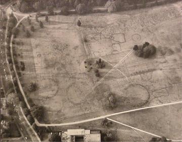
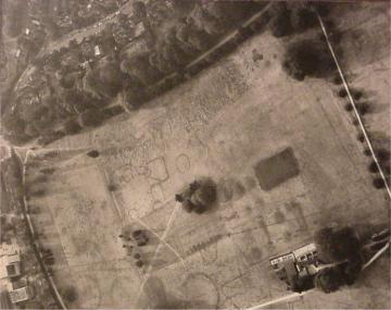
Crop Marks
Aerial Photographs of the Crop Marks in the University Parks
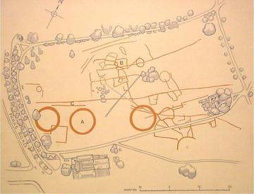
Reproduced from an exhibit in the Oxford University Museum of Natural History, Parks Road, Oxford, OX1 3PW.
The photographs and interpretation show the Bronze Age and Romano-British remains in the University Parks, revealed by differential growth of vegetation during a dry summer. These crop marks are due to the longer and lusher growth of grass and weeds over ditches and other soil-filled excavations in the terrace gravels which form the substratum of the Parks area.
The three large circles (A) are part of a Wessex-type Linear Barrow Cemetery dating from early in the second millennium BC to the second century AD. They mark the boundaries of farmsteads inhabited by the peasants whose remains (exhibited in the University Museum) were discovered in front of the University Museum in 1970.
Crop markings (West)
Aerial map
Crop markings (East)